

Island (4)
 情報追加
情報追加
 ホームページ >
 Homepage >
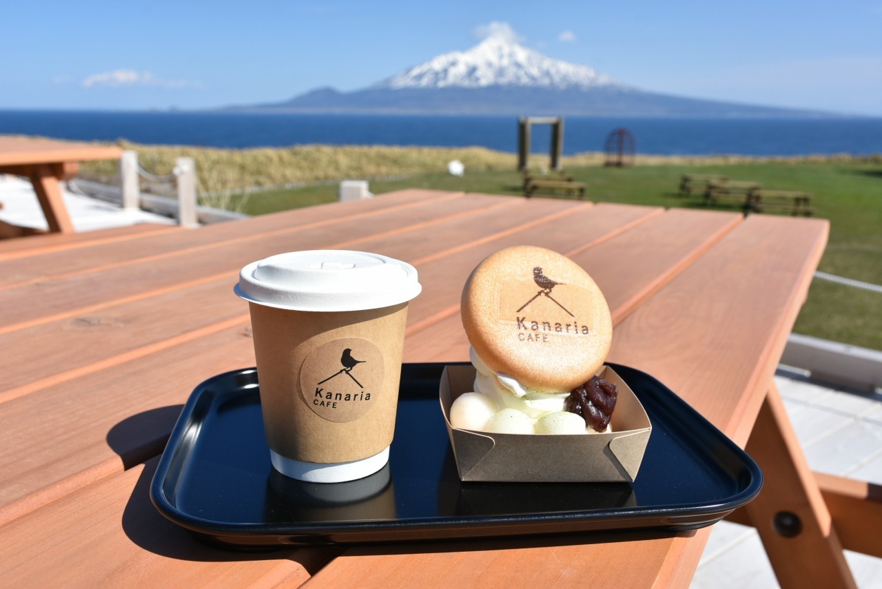
Kanaria Park Cafe, Rebun Island
Phone: 0163-86-1001
Address: 字フンベネフ671 北のカナリアパーク Kafukamura, Rebun, Rebun District, Hokkaido 097-1201
Open: 10am to 12:30pm then 1pm to 4pm (L.O. 3:30pm) Takeout till 4pm
URL: https://www.town.rebun.hokkaido.jp/hotnews/detail/00000171.html
For The Taxi Driver:
〒097-1201 北海道礼文郡礼文町香深村字フンベネフ671 北のカナリアパーク
GPS: 45.27762447923392, 141.04148339144893 (Google Maps)
Places To Visit Around Soya Subprefecture, Hokkaido, Japan ... Read more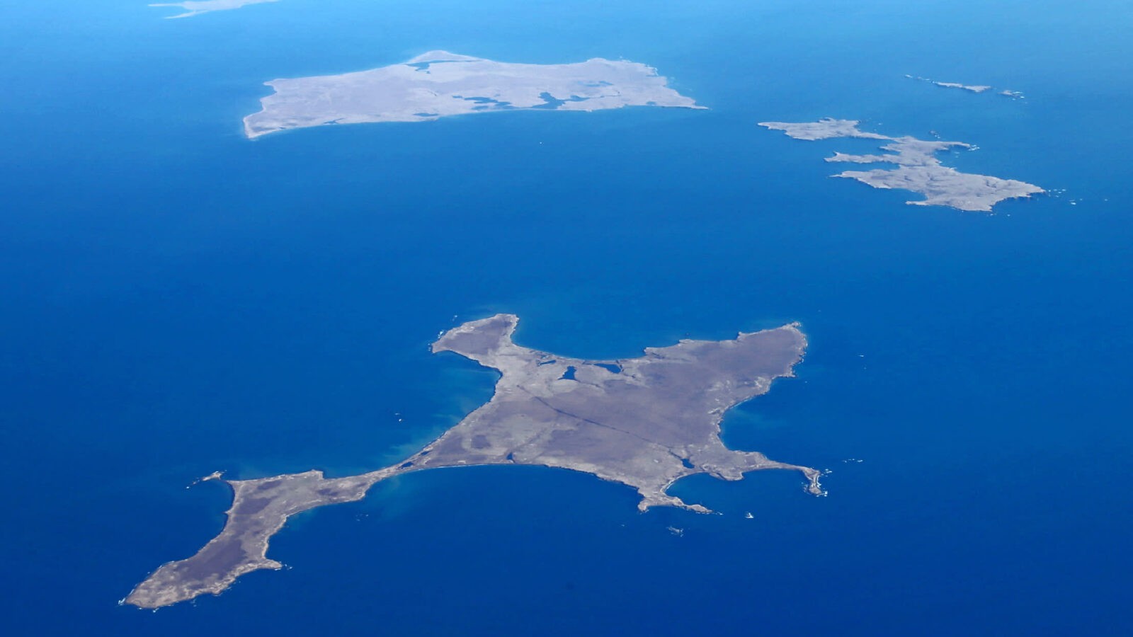
歯舞諸島(はぼまいぐんとう)
島の一覧 島名Japanese
Name Russian
Name Ainu
Name Area
km2 Highest point
m Latitude
N Longitude
E Distance from Cape Nosappu
km 色丹島 Shikotan 色丹島
しこたんとう
Shikotan tō Остров Шикотан Si-kotan (Big village) 255 412.6 43°47' 146°44' 73.3 principal marine products being cod, crab, and kelp
GPS: 43.80309051967712, 146.74656631042993
Spangberg Channel(Habomai islands are shown below.)
Shikotan Channel
Habomai Islands (Visa Needed)
List of islands IslandJapanese
Name Russian
Name Ainu
Name Area
km2 Highest point
m Latitude
N Longitude
E Distance from Cape Nosappu
km Shikotan Shikotan 色丹島
しこたんとう
Shikotan tō Остров Шикотан Si-kotan (Big village) 255 412.6 43°47' 146°44' 73.3 principal marine products being cod, crab, and kelp
GPS: 43.80309051967712, 146.74656631042993
Spangberg Channel(Habomai islands are shown
... Read more
Shikotan Island (Visa Needed)
GPS: 43.794542355841166, 146.7470546046475
The total land area of Shikotan is 225 km². The island is hilly, averaging 300 metres in elevation. The shores of the island are very indented and covered with oceanic meadows. The highest altitude is 412 m. The island is formed by the volcanic rock and sandstone of the Upper Cretaceous
... Read more応用並べ替えフィルターSearch Filter Applied:
 Contact Us