カテゴリーページ
Click Link, Image or Button to View Category Posts
Eastern Islands (5)
 情報追加
情報追加
 ホームページ >
 Homepage >
Kunashiri Island, Kunashiritou (2); Etorofu Island (1); Habomai Islands, Habomaigun (2); Shikotan Island (1); Hopporyoudo (3); Chishimarettou (0)

Habomai Islands (Visa Needed)
List of islands Island Japanese Name Russian Name Ainu Name Area km2 Highest point m Latitude N Longitude E Distance from Cape Nosappu km Shikotan Shikotan 色丹島 しこたんとう Shikotan tō Остров Шикотан Si-kotan (Big village) 255 412.6 43°47' 146°44' 73.3 principal marine products being cod, crab, and kelp GPS: 43.80309051967712, 146.74656631042993 Spangberg Channel(Habomai islands are shown below.) Shikotan Channel ... Read more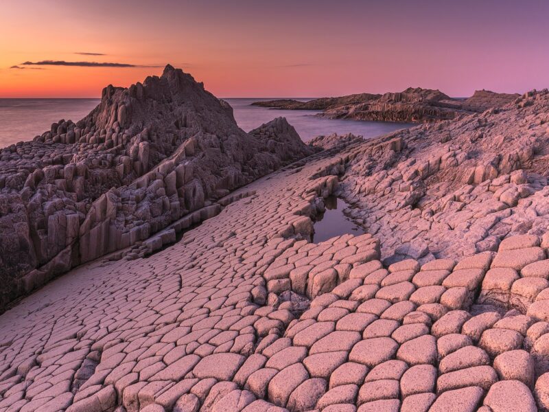
Cape Stolbchaty, Kunashir Island (Visa Needed)
Cape Stolbchaty on the eastern side of the Kunashir Island. GPS: 44.02542696671918, 145.6765122403166 Nature Kamuiwakka Yunotaki Hot Falls, Shiretoko Beach Cape Kamui, Shakotan Mt. Tento Kanrosensui Spring (Rishiri Island) Biei Flower Fields / Gardens / Farms Sunflower Maze Onuma Park Shimamui Coast, Shakotan Kushiro Marshland Ponyama / Mt. Pon (Rishiri Island), Hokkaido, Japan Ubaranai SANGO Grassland ... Read more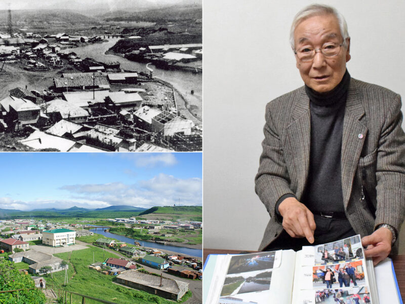
Etorofu Island, Shana Village (Visa Needed)
(Upper left) Shana Village (択捉島紗那村) in pre-war days. (Lower left) Current view of the same photo as above. (Right) Mr. Tadaaki Iwasaki (岩崎忠明), a former islander GPS: 45.229253865539874, 147.87380375356503 Late spring when all the flowers are in bloom Mr. Tadaaki Iwasaki, 82, who now lives in Sapporo, was born and raised in Shana Village on ... Read more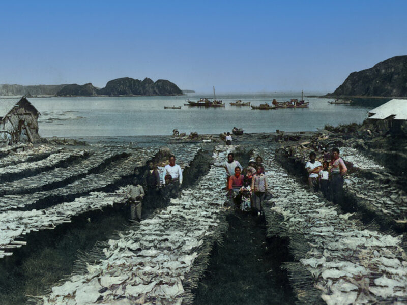
Shikotan Island (Visa Needed)
GPS: 43.794542355841166, 146.7470546046475 The total land area of Shikotan is 225 km². The island is hilly, averaging 300 metres in elevation. The shores of the island are very indented and covered with oceanic meadows. The highest altitude is 412 m. The island is formed by the volcanic rock and sandstone of the Upper Cretaceous and ... Read more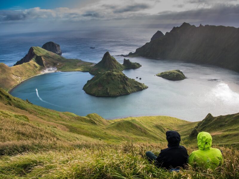
Kurilskiy State Nature Reserve (Visa Needed)
Phone: +7 424 55 21 502 (Reserve Administration) Address: 5 Zarechnaya St., Yuzhno-Kurilsk, Kuril Islands, Russia 694500 Ecological Education and Ecotourism Department kurilskiy @ mail.ru or kurilskiy @ gmail.com https://peakvisor.com/park/kurils-nature-reserve.html GPS: 44.098971444493976, 145.8991962119183 Golovnin Volcano Yankicha Island, Kuriles. Photo: Vladimir Klyushkin Most popular sites to visit are: Golovnin Volcano Caldera Tyatya Volcano The Pillar Cape (Stolbchaty Cape) ... Read more応用並べ替えフィルターSearch Filter Applied:
 Contact Us