カテゴリーページ
Click Link, Image or Button to View Category Posts
Hiking (13)
 情報追加
情報追加
 ホームページ >
 Homepage >
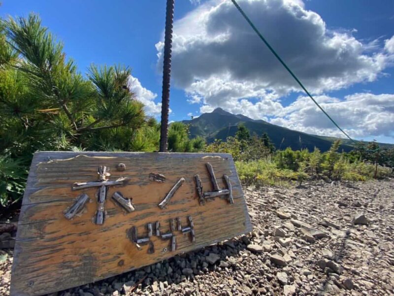
Ponyama / Mt. Pon (Rishiri Island), Hokkaido, Japan
Mt. Pon and Kanrosensui Course Address: Rishirifuji Town, Rishiri District, Hokkaido 097-0100 GPS: 45.22392961576974, 141.21954545860714 (Google Maps) Course Outline This course takes you from the trailhead (Hokuroku Camping Ground), past the Ganro fountain, to the Ponsan course from the Himenuma junction, and around the Little Ponsan and Ponsan mountains. The view from the 444-meter-high Mount ... Read more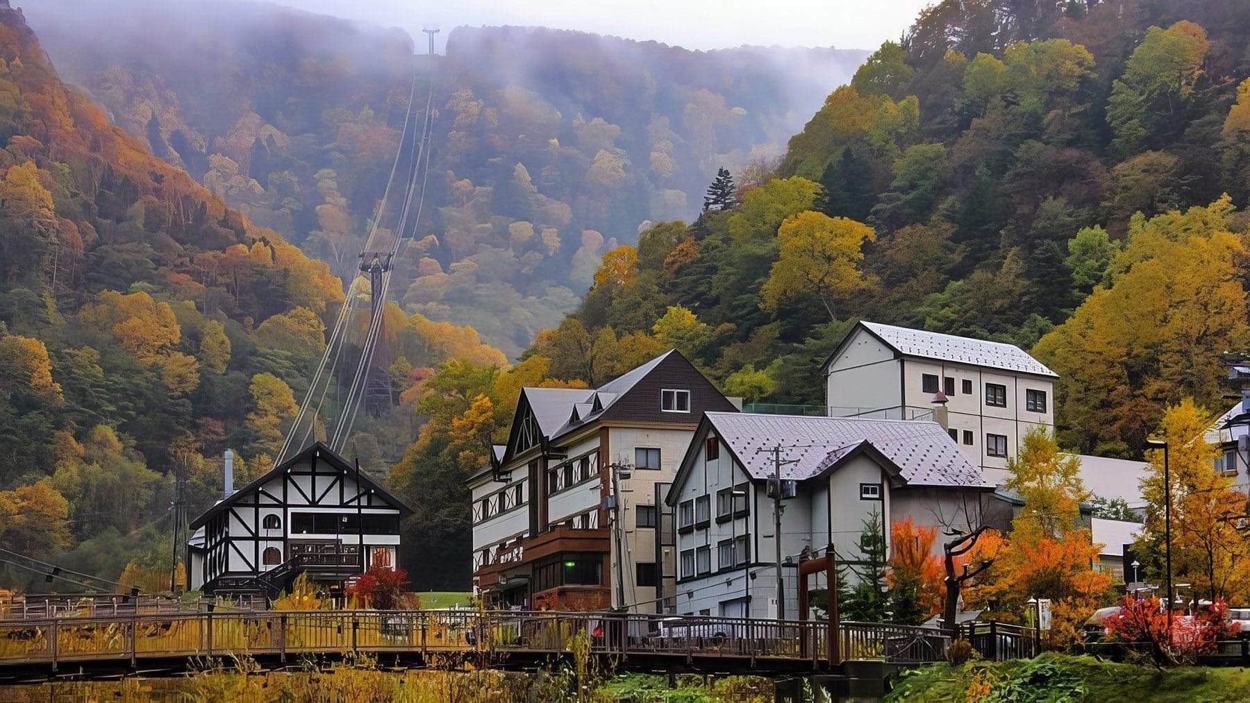
Sounkyo Onsen Town - Kamikawa - Daisetsuzan National Park
Phone: 0165-82-1811 (Sounkyo Tourism Association) Address: Kamikawa, Kamikawa District, Hokkaido 078-1701 Sounkyo Tourism Association, Chuo-cho, Kamikawa-cho, Kamikawa-gun, Hokkaido 078-1741 Facebook: https://www.facebook.com/sounkyo.onsen Instagram: https://www.instagram.com/sounkyo_onsen URL: https://sounkyo.net/ For The Taxi Driver: 〒078-1701 北海道上川郡上川町中央町 / 層雲峡観光協会 〒078-1741 北海道上川郡上川町中央町605番地 森のテラスヌプリ GPS: 43.72676736902637, 142.94740994765667 (Google Maps) Sounkyo (層雲峡, Sōunkyō) is a touristy hot spring resort town in the north ... Read more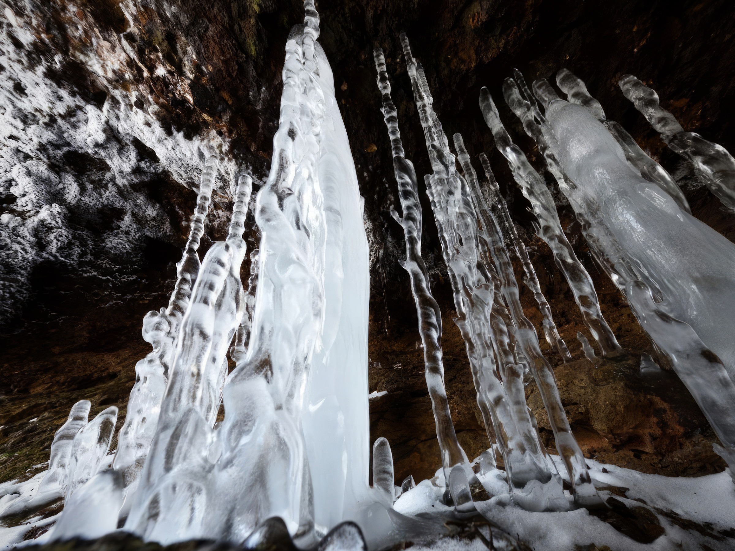
Karurusu Ice Caves, Noboribetsu - Ice Bamboo
Address: Karurusu Copper Mine, Noboribetsu, Hokkaido, Japan Open: 24/7 Charge: Free Tour Price: Around 20,000 yen per person (tax included). The Noboribetsu Karurusu Ice Pillars Tour (a 6 hour guided tour) is a tour to see ice pillars in the caves of an old mine in Karurusu, Noboribetsu. It's usually a 9am start (meeting 8:45am, ... Read more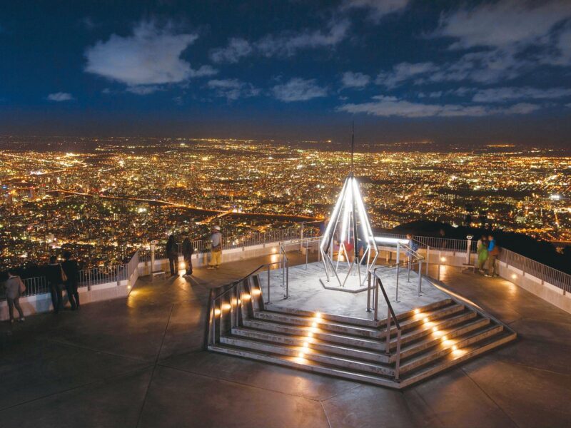
Mt. Moiwa Night View
Mt. Moiwa Summit Observation Deck Elevation: 531m Open: 10:30am to 10pm (Apr - Nov), 11am to 10pm (Dec - Mar), Last Ropeway Car 9:30pm New Year's Day: The ropeway operates from 5am - 9am only. Closed: If there is bad weather and sometime in November for maintenance. December 31st. URL: https://mt-moiwa.jp This night view in ... Read more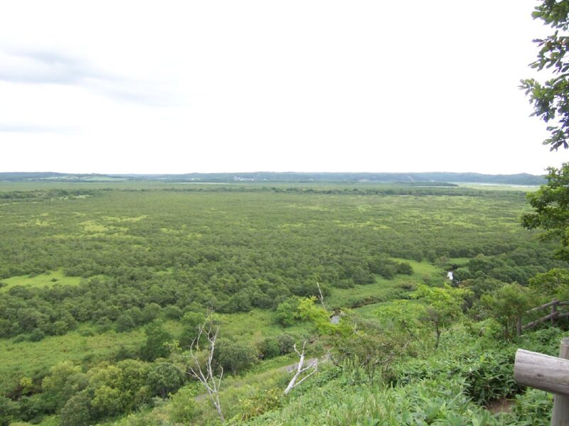
Kushiro Marshland
Address: 6-11, Hokuto, Kushiro-shi, Hokkaido The Kushiro Marshland (釧路湿原, Kushiro Shitsugen) in Hokkaido was designated as a national park in 1987 in order to preserve the country's largest wetland and marsh habitat which supports the only known population of endangered Japanese Cranes in Japan. The park is located between Kushiro and Akan National Park and ... Read more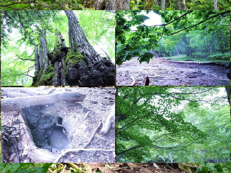
Rare Encounters: An 800-Year-Old Tree! Hokkaido's Forest of Light
800-Year-Old Tree Phone: 0154-67-4100 (Akankohan Eco Museum Center) Address: Akankohan Eco Museum Center: 1 Chome-1-1, Akancho, Akanko Onsen, Kushiro, Hokkaido 085-0467 The Tree's Location: Akan Lakeside (On Maeda Ippoen Foundation's Private Property) Price: Adults about ¥8,400 + TAX, children about¥4,200 + TAX Duration: Approximately 2.5 hours View Larger Map For The Taxi Driver: 〒085-0467 ... Read more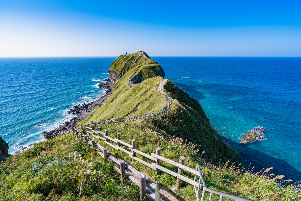
Cape Kamui, Shakotan
Phone: 0135-44-3715(Shakotan Tourism Association) Address: Kozakicho, Shakotan, Shakotan District, Hokkaido 046-0321 Hours: The gate that leads to the end of the cape. April: 8am to 5:30pm / May: 8am to 6pm / June: 8am to 6:30pm / July: 8am to 6pm / August to October: 8am to 5:30pm / November: 8am to 4:30pm / ... Read moreShimamui Coast, Shakotan
Phone: 0135-44-3715 Address: Irikacho, Shakotan, Shakotan District, Hokkaido Prefecture 046-0327 Open: Open 24 Hours Charge: Free parking & open all year URL: https://hokkaido-shakotan.com/shimamuikaigan/ For The Taxi Driver: Irikacho, 積丹町 積丹郡 北海道 046-0327 GPS: 43.374181165396266, 140.47859435563822 A 2 hour drive from Sapporo. You can find a restaurant here that sells seafood, mainly sea urchin, ice ... Read more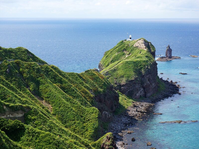
Kamui Rock, Cape Kamui
Phone: 0135-44-3715(Shakotan Tourism Association) Address: Kozakicho, Shakotan, Shakotan District, Hokkaido 046-0321 Website: https://www.kanko-shakotan.jp/en/spot/cape-kamui-and-kamui-rock/ Car Park: 300 spaces GPS: 43.33604105102228, 140.34281910725062 (Google Maps) There is a gate at the entrance to Cape Kamui and its opening hours vary by month as shown below. It takes around 40 minutes to make a round trip along the ... Read more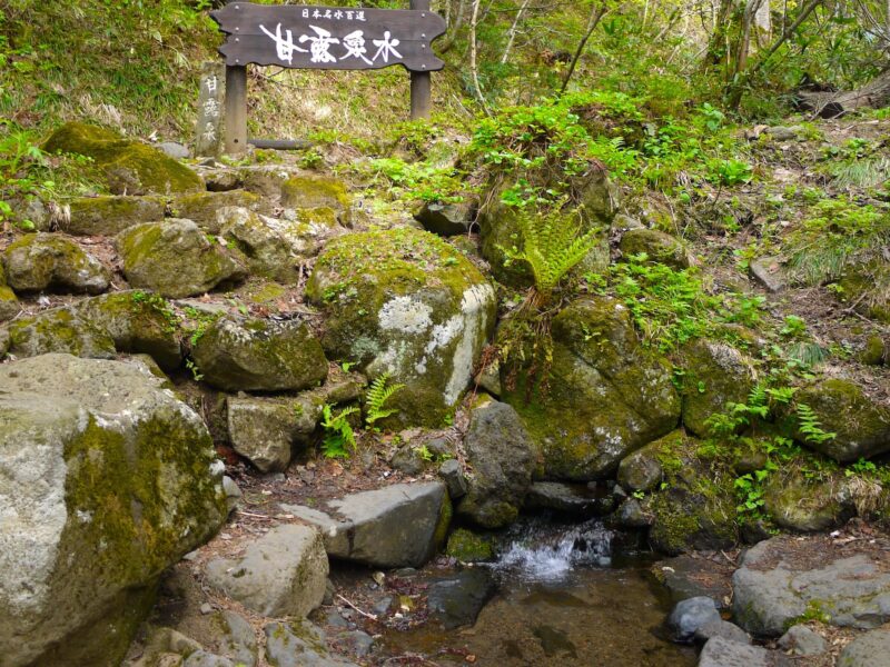
Kanrosensui Spring (Rishiri Island)
Kanrosensui Course Address: Rishirifuji Town, Rishiri District, Hokkaido 097-0100 Course Outline This course takes you from the trailhead (Hokuroku Camping Ground), to the Kanro fountain. GPS: 45.22077332138965, 141.21688759617734 Rishiri Island UNBALLON Soup Curry Dining (Rishiri Island) Closed Ponyama / Mt. Pon (Rishiri Island), Hokkaido, Japan Nagisa Izakaya (Rishiri Island) Soya Subprefecture Usotannai Placer Gold Mining ... Read more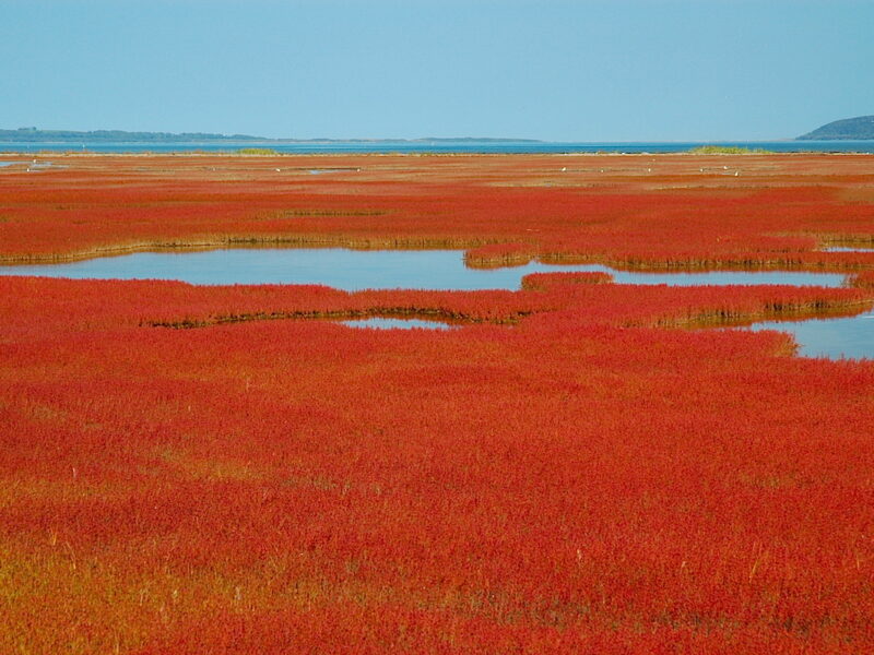
Ubaranai SANGO Grassland
Address: 60-3 Ubaranai, Abashiri, Hokkaido 093-0135 In autumn, a part of Noto Lake is covered with red coral grass, which gives it a different look from the autumn leaves. Due to this coral grass colony of Noto Lake, a wooden boardwalk has been set up to allow visitors to walk through the middle of the ... Read more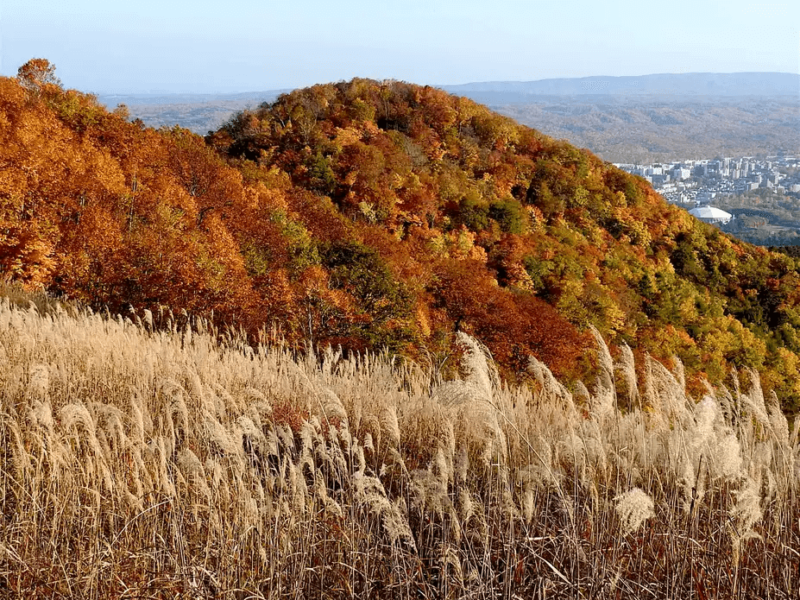
Mt. Moiwa
Mt. Moiwa, a recommended mountain for climbing in autumn Sapporo City The Best Time to See Autumn Leaves: Mid-October to Late October Mt. Moiwa: Elevation, Fall Foliage Season and Course Time Elevation: 531m Best Time to Visit: Mid-October to late October Course Time: About a 2 hour round trip (Jikei Course) The primeval forest of ... Read more応用並べ替えフィルターSearch Filter Applied:
 Contact Us