カテゴリーページ
Click Link, Image or Button to View Category Posts
Nature (37)
 情報追加
情報追加
 ホームページ >
 Homepage >
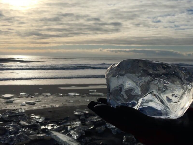
Toyokoro Jewel Ice
Phone: 015-574-2216 (Toyokorocho Public Office Planning Division) Address: Otsu Coast Observatory, Otsu Beach, Otsu Motomachi, Toyokoro-cho, Nakagawa-gun, Hokkaido When: Mid-January to late February URL: https://www.toyokoro-kankoh.com/ GPS: 42.689320088812636, 143.6573182027556 The Jewelry Ice of Toyokoro-cho Access: 45 min. by car from Tokachi Obihiro Airport to Toyokoro Town In winter, when it is below about -20°C (-4°F), the Tokachi ... Read more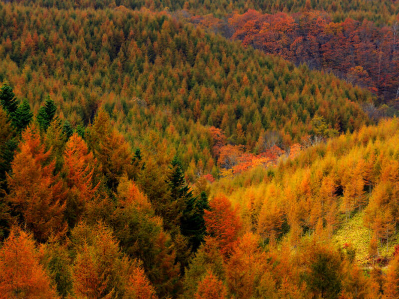
Urahoro Forest
Phone: 055763455 Area: 22-1 Higashiyamacho, Urahoro, Tokachi District, Hokkaido 089-5612 GPS: 42.809377034998604, 143.66744288324765 Nature Sunflower Maze Karurusu Ice Caves, Noboribetsu - Ice Bamboo Ubaranai SANGO Grassland Kushiro Marshland Toyokoro Jewel Ice Kamui Rock, Cape Kamui Mt. Moiwa Rare Encounters: An 800-Year-Old Tree! Hokkaido's Forest of Light Kanrosensui Spring (Rishiri Island) Tenjinyama Park Cape Kamui, Shakotan ... Read more
Sangaitaki Park
Address: Otakiku Sangaitakicho, Date, Hokkaido 052-0303 Map Code: 759 013 488*33 GPS: 42.674382755594515, 141.10552737022496 Nature Nakajima Park, Sapporo, Hokkaido, Japan Urahoro Forest Shichiku Garden, Biei, Obihiro Ginko Avenue, Hokkudai (October/November) Biei Flower Fields / Gardens / Farms Mt. Moiwa Mt. Tento Ponyama / Mt. Pon (Rishiri Island), Hokkaido, Japan Otaru Dream Beach Yagishiri Men Hitsuji ... Read more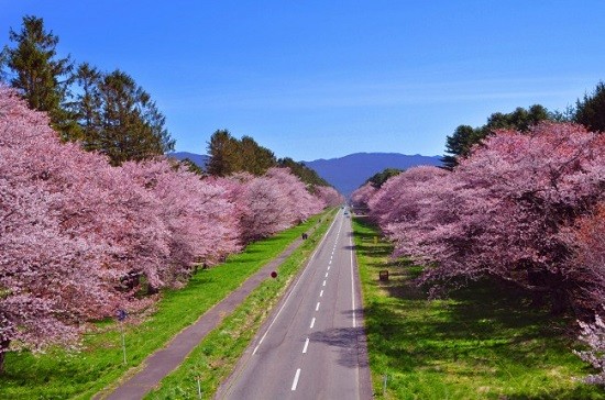
Nijukken Road / Hokkaido
Address: Shizunaitahara, Shinhidaka, Hidaka District, Hokkaido 056-0144 GPS: 42 Name Nijukken Road (二十間道路) Best Viewing Early May – Mid-May Address Shizunai-tahara – Shizunai-misono, Shinhidaka-cho, Hidaka-gun, Hokkaido, Japan Access 15 minute walk from Sakuraoka-shougakkou-mae bus stop on Donan Bus from Shizunai Station (JR line) *Shuttle bus available during festival from Shizunai Station Map Google Map Nature Yagishiri ... Read more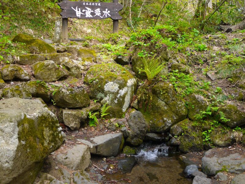
Kanrosensui Spring (Rishiri Island)
Kanrosensui Course Address: Rishirifuji Town, Rishiri District, Hokkaido 097-0100 Course Outline This course takes you from the trailhead (Hokuroku Camping Ground), to the Kanro fountain. GPS: 45.22077332138965, 141.21688759617734 Rishiri Island Nagisa Izakaya (Rishiri Island) UNBALLON Soup Curry Dining (Rishiri Island) Closed Ponyama / Mt. Pon (Rishiri Island), Hokkaido, Japan Soya Subprefecture Toyotomi Hot Springs Okhotsk ... Read more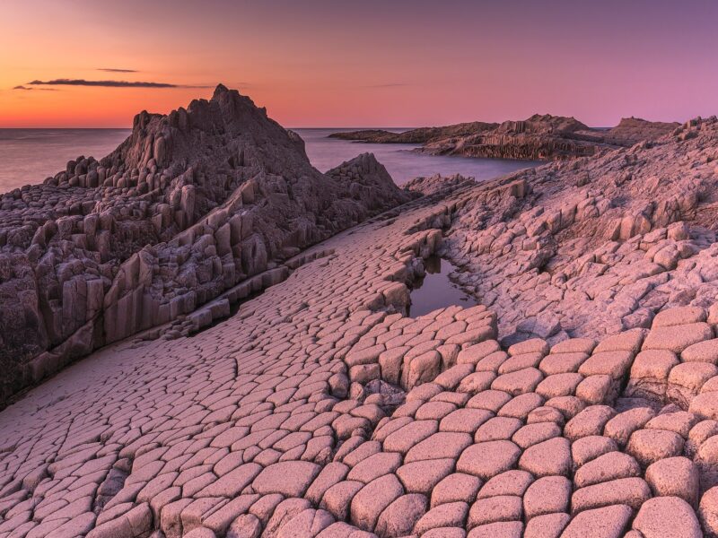
Cape Stolbchaty, Kunashir Island (Visa Needed)
Cape Stolbchaty on the eastern side of the Kunashir Island. GPS: 44.02542696671918, 145.6765122403166 Nature Blue Pond, Shirogane, Biei Nijukken Road / Hokkaido Garo Falls Shichiku Garden, Biei, Obihiro Kurilskiy State Nature Reserve (Visa Needed) Ubaranai SANGO Grassland Wind Garden Furano Toyokoro Jewel Ice Rare Encounters: An 800-Year-Old Tree! Hokkaido's Forest of Light Nakajima Park, Sapporo, Hokkaido, ... Read more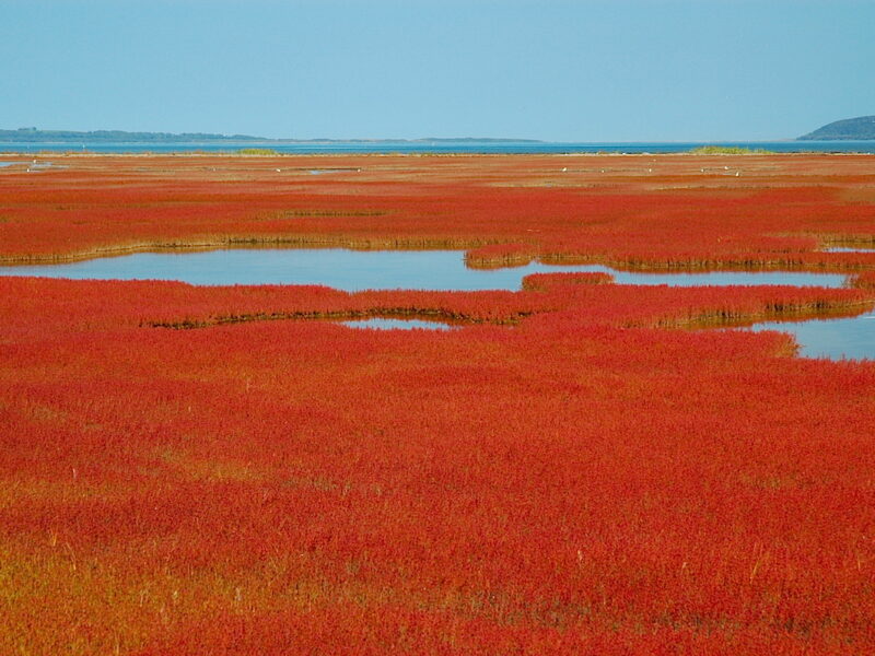
Ubaranai SANGO Grassland
Address: 60-3 Ubaranai, Abashiri, Hokkaido 093-0135 In autumn, a part of Noto Lake is covered with red coral grass, which gives it a different look from the autumn leaves. Due to this coral grass colony of Noto Lake, a wooden boardwalk has been set up to allow visitors to walk through the middle of the ... Read more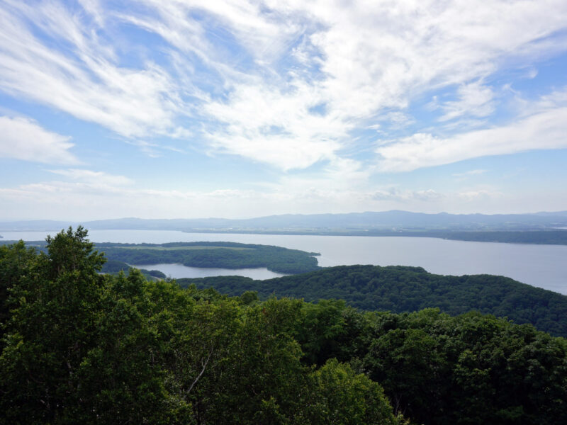
Mt. Tento
Address: 245 Tentozan, Abashiri, Hokkaido 093-0044 Mount Tento (天都山, Tentozan) is a nationally designated place of scenic beauty in Abashiri, Hokkaido, Japan. Rising to a height of 207 metres, the mountain commands views over the Sea of Okhotsk, Lake Abashiri, Lake Notoro, Lake Tōfutsu, and, from afar, the Shiretoko Peninsula also Akan Volcanic Complex. For The ... Read more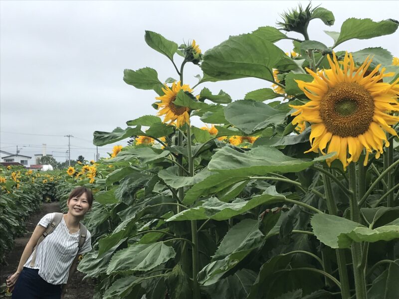
Sunflower Maze
Where: Sunflower Farm, Honbetsu, Tokachi 北海道中川郡本別町美里別東中地区 When: Usually August 11th to 16th Open: 9am to 5pm Fee: Adults 200 Yen, Kids 100 Yen Map Code: 481 147 593*71 GPS: 43.1602377761627, 143.52542061970723 Tokachi Subprefecture Kamishihoro – Promotion Video Obihiro - Promotional Video Club Med Sahoro, Kamikawa North Candles, Eco-friendly Soy Wax Toyokoro Jewel Ice Nakasatsunai Snow ... Read more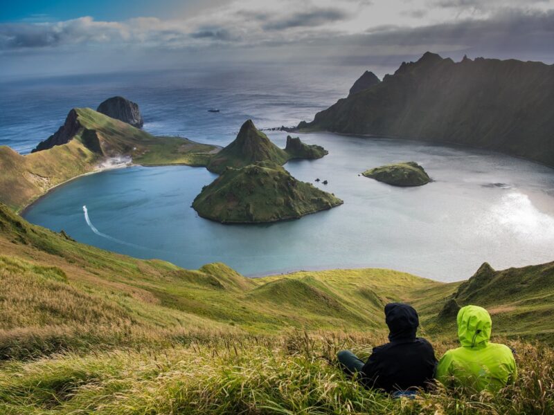
Kurilskiy State Nature Reserve (Visa Needed)
Phone: +7 424 55 21 502 (Reserve Administration) Address: 5 Zarechnaya St., Yuzhno-Kurilsk, Kuril Islands, Russia 694500 Ecological Education and Ecotourism Department kurilskiy @ mail.ru or kurilskiy @ gmail.com https://peakvisor.com/park/kurils-nature-reserve.html GPS: 44.098971444493976, 145.8991962119183 Golovnin Volcano Yankicha Island, Kuriles. Photo: Vladimir Klyushkin Most popular sites to visit are: Golovnin Volcano Caldera Tyatya Volcano The Pillar Cape (Stolbchaty Cape) ... Read more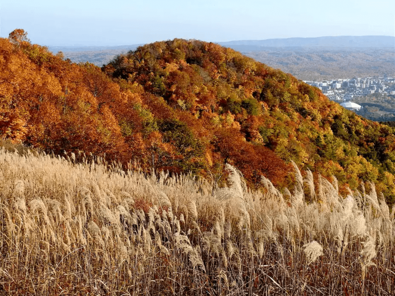
Mt. Moiwa
Mt. Moiwa, a recommended mountain for climbing in autumn Sapporo City The Best Time to See Autumn Leaves: Mid-October to Late October Mt. Moiwa: Elevation, Fall Foliage Season and Course Time Elevation: 531m Best Time to Visit: Mid-October to late October Course Time: About a 2 hour round trip (Jikei Course) The primeval forest of ... Read more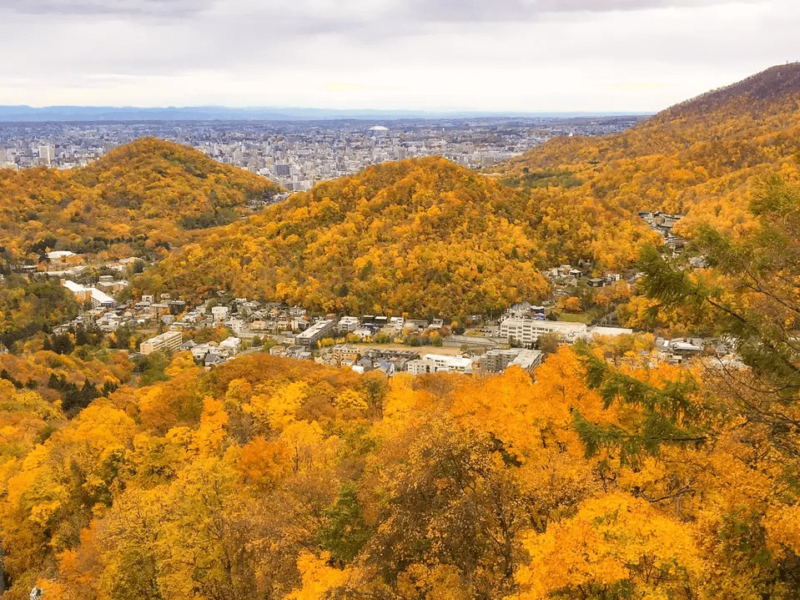
Sankakuyama
Recommended Mountains to Climb Autumn Foliage: Sankakuyama (三角山) Sapporo City The Best Time to See Autumn Leaves: Mid-October to Late October Mt. Sankaku; Sankakuyama; Triangle Mountain Area: Kutchan-chō, Abuta-gun, Hokkaido, Japan Elevation: 311m Best Time to Visit: Mid-October to late October Approximate Course Time: About 1 hour round trip Located in Sapporo City, Mt. Sankaku is a satoyama ... Read more応用並べ替えフィルターSearch Filter Applied:
 Contact Us